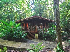
A collection of small, charming luxury hotels and lodges in Costa Rica, each featuring its own original character and style – special, different, with first class services conceived for a demanding upscale tourist. We believe in good environmental hotel practices, and are committed to Costa Rica's CST certification of sustainable tourism.
viernes, 28 de junio de 2013
jueves, 27 de junio de 2013
Exciting volcanic action happening at Rincon de la Vieja
With Costa Rica's most famous active volcano – Arenal – behaving quietly for the past three years, tourists to this Central American hotspot are looking elsewhere for exciting fireworks.
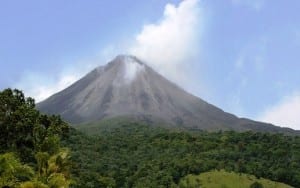 There are actually six active volcanoes in Costa Rica, and another 61 that are dormant or extinct. For the past 50 years, Arenal was the country's most active volcano; however, in 2010, the celebrated cone-shaped peak entered a "resting phase" – meaning that its daily and nightly fantastic eruptions have ceased for the most part. While Arenal is still one of Costa Rica's most visited sites, some of the country's other active volcanoes are equally impressive.
About 3 million years ago, Costa Rica and its neighbors of Nicaragua and Panama were a volcanic archipelago rising from the sea in the "Pacific Ring of Fire," 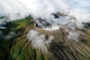 an area of the world from Asia to South America infamous for its profuse volcanic activity. Fast forward to 600,000 years ago, and that's when the geologic wonder of the Rincón de la Vieja Volcano was born. Located in Costa Rica's northern Guanacaste plains, the giant cinder cone bridges the Continental Divide as part of nine contiguous craters in the Rincón de La Vieja National Park.
 an area of the world from Asia to South America infamous for its profuse volcanic activity. Fast forward to 600,000 years ago, and that's when the geologic wonder of the Rincón de la Vieja Volcano was born. Located in Costa Rica's northern Guanacaste plains, the giant cinder cone bridges the Continental Divide as part of nine contiguous craters in the Rincón de La Vieja National Park.
Rincón de la Vieja Volcano, whose name means "Corner of the Old Woman" from an indigenous legend, is the largest volcano in the country's northwest region. Soaring 6,286 feet into the sky, its caldera is 9 miles (15 km) wide. The adjacent dormant Santa Maria Volcano stands even taller at 6,307 feet. The most active crater, called the Von Seebach, has near vertical sides denuded of vegetation near the top and frequently vents steam and gases. The last major eruption was in 1998. The mighty volcano's activity once served as a natural lighthouse for ships at sea
.
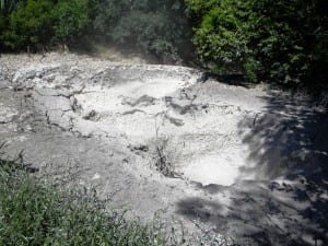 These days, visitors to Rincón de la Vieja Volcano are treated to quite a show. More than 30 rivers flowing down the mountainsides create countless thermal springs and waterfalls. Walk the easy 2.5 mile loop trail in the National Park's Las Pailas ("The Cauldrons") section, and you'll witness firsthand the explosive steam vents, boiling volcanic sulfur-water pools, and striking bubbling volcanic mud pits. There is a very challenging 6-mile (10 km) hike ascending 5,000 feet to the top of the active crater, however most of the time the trail is closed due to the crater's high activity.
Located 15.5 miles (25 km) northeast of Guanacaste's principal city of Liberia, Rincón de la Vieja National Park's 34,800 acres are split into the two sectors of Santa María and Las Pailas, which has the active crater. The park's diverse ecosystems offer a wide 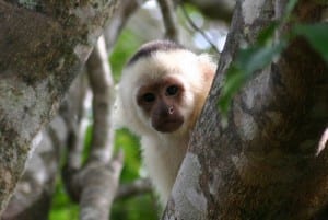 variety of flora. Its high forested slopes are home to gnarled dwarf trees draped in moss mats that provide the arboreal base for orchids and epiphytes. You can find numerous "Guaria Morada" (purple) orchids, Costa Rica's national flower; and in the thick dry tropical forest is an immense 800-year-old Ceiba tree. Wildlife is plentiful. Rincón de la Vieja counts 300 bird species, including the Crested Guan, Blue-crowned Motmot and Emerald Toucanet, as well as a variety of mammals such as collared peccaries, agoutis, nine-banded armadillos, white-nosed coatis, raccoons and three species of monkeys (white-faced Capuchin, howler and spider).
 variety of flora. Its high forested slopes are home to gnarled dwarf trees draped in moss mats that provide the arboreal base for orchids and epiphytes. You can find numerous "Guaria Morada" (purple) orchids, Costa Rica's national flower; and in the thick dry tropical forest is an immense 800-year-old Ceiba tree. Wildlife is plentiful. Rincón de la Vieja counts 300 bird species, including the Crested Guan, Blue-crowned Motmot and Emerald Toucanet, as well as a variety of mammals such as collared peccaries, agoutis, nine-banded armadillos, white-nosed coatis, raccoons and three species of monkeys (white-faced Capuchin, howler and spider).
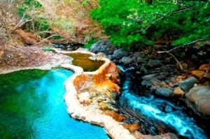 Near the Santa María park entrance there are rustic hot springs and a cold water river. By the Las Pailas park entrance, Hotel Hacienda Guachipelin has developed three hot springs locations – Sulphur Springs ("Azufrales"), Negro River and Colorado River – where you can soak in soothing steamy mineral waters.
Hacienda Guachipelín Hotel is the ideal place to stay at Rincón de la Vieja Volcano for an active vacation. The first-class ecotourism lodge is a thrilling center for adventure and nature lovers, offering canopy zip lines, canyoning, waterfall rappelling, river tubing, horseback riding, nature trails, and thermal springs – all on a working horse and cattle ranch.
Hacienda Guachipelín offers guided hikes in the Las Pailas sector of the Rincón de la Vieja National Park. The Park Ranger Stations at both the Pailas and Santa Maria sectors of the Park are open daily from 8 a.m. to 4 p.m.
Costa Rica's 6 active volcanoes: * Arenal Volcano (National Park) in the Northern Plains had a massive eruption in 1968 that destroyed the surrounding town. Since then, it has been Costa Rica's most active and most visited volcano; its hot springs are world famous. * Irazú Volcano (National Park), in the Central Valley above Cartago, is the tallest at 11,260 feet, with two calderas filled with water and rising steam. * Poás Volcano (National Park), in the Central Valley above Alajuela, is one of Costa Rica's largest and most active volcanoes. Although the last major eruption was in 1910, Poás still regularly gives visitors a show with geysers of steam, gases and water from its crater acid lake exploding into the air. * Rincón de la Vieja Volcano (National Park) in Guanacaste is highly active with fumaroles, bubbling volcanic mud pits, steam vents and hot springs. * Tenorio Volcano (National Park) in Guanacaste is known for its hot springs and the beautiful Rio Celeste, whose sky blue waters are caused by volcanic minerals mixing together. * Turrialba Volcano (National Park) in the Southeastern Highlands had its last major eruption in 1868; however, smoke and gas explosions have increased over the past couple of years, and today volcanologists maintain a constant vigil.
By Shannon Farley
¿Qué pasa con las tortillas en Manuel Antonio?
Era una mañana un tanto calurosa en el Parque Nacional Manuel Antonio. Acababa de visitar los predios de la zona y la humedad del ambiente pudo más que yo. Me dispuse a retomar el aliento sobre una de las bancas. Mientras descansaba bajo la sombra y sentía la brisa del mar, me percaté de que tenía hambre. Recordé que después de salir de Portasol había comprado dos paquetes de tortillas tostadas y las llevaba en la mochila.
 El ir y venir de las olas me arrulló exquisitamente, por lo que dejé caer la bolsa de chucherías. La levanté de inmediato, aunque parte de su contenido quedó en el suelo. Seguidamente, la fauna reaccionó ante el evento y me mostró un espectáculo digno de ser compartido.
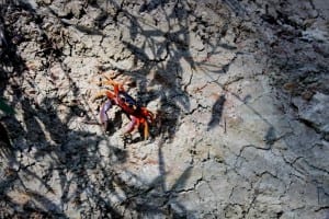
Un cangrejo avispado corrió hacia la tortilla que yacía en el suelo. Cogió parte de ella y se enrumbó hacia su guarida. Estos animales, allende sus tenazas, son más viciosos de lo que parecen. Su comportamiento es propio de seres aprovechados, resentidos y prepotentes; incluso más que algunas personas que conozco. A la postre, pierden todo control al ver comida gratuita.
Entonces, cuando nuestro primer personaje iba para su escondite, otro doblemente astuto logró hacerse con el preciado tesoro. Sin embargo, como dice el refrán popular: «el que a hierro mata, a hierro muere». Había recorrido poco cuando un tercero le robó el mandado. Como por arte de magia, aparecieron varios más que me andaban desenfrenadamente por los pies. Ellos también querían merendar. Por eso, cada vez que se encontraban con otro miembro de su propia especie arremetían a traición contra este, sin importar si tuviera o algo en su haber. La tortilla era suficiente para que muchos comieran, pero ellos preferían robar las piezas de sus compañeros. Supongo que pensaban que era más fácil saquear una ajena que conseguir la propia. Eso sí, su egoísmo les salió caro.
Aún había comida disponible cuando dos mapaches llegaron al lugar de los hechos. Su sola presencia fue suficiente para espantar a los cangrejos –ya de por sí trastornados–. Tomaron el restante y lo sacudieron como para quitarle la arena. Aquellos ojos pequeños y negros me contemplaban con ternura, como queriendo seducirme para que les diera más manjar. Mientras tanto, las patas delanteras hacían ademanes mientras se llevaban la comida al hocico, con encanto y sin prisas. Así hasta terminar.
Emocionado por aquel entretenimiento, me incorporé para tomarles una foto. El más audaz aprovechó el descuido para coger de la mesa otro paquete completo. Ilusamente, lo perseguí mientras encontraba refugio en el manglar donde seguramente se iba a dar gusto con un gran festín. Sin embargo, su felicidad fue efímera.
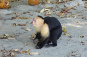 Aquello fue como una llamada para los monos cariblancos, que se aproximaron con gran prisa. Esto provocó el estupor del otro mapache que se acercó a mi lado como para que lo protegiera. Los primates se disputaron la bolsa de manera más «civilizada» y tomaban turnos para comer. Ante estos eventos, los visitantes del área ya me rodeaban y hacían fotos aprovechándose de mi complacencia.
Los monos parecían acostumbrados a las circunstancias y trataban de convencerme que les diera otro paquete. Lo malo es que las restricciones del parque prohíben darles de comer a los animales. Sin intención ni alevosía, había roto las reglas, por lo que decidí asir con fuerza la bolsa de la discordia. Pero como los monos no tienen vergüenza, intentaron arrebatarme el objeto.
Agotado por el acoso, decidí que lo mejor era irme del sitio. Caminé por la playa mientras me alejaba de aquellos hermosos animales. Al mismo tiempo reflexionaba sobre el equilibrio tan frágil de la naturaleza y cómo este no debería ser alterado por la raza humana. Continué el recorrido por las arenas limpias, mojándome los pies mientras analizaba qué otro daño puede causar la mala voluntad de nuestra raza en la naturaleza. Afortunadamente, aún existen zonas protegidas que mantienen a las personas alejadas de los otros animales.
Por: Andrés Figueroa Vásquez.
martes, 25 de junio de 2013
Portasol plays key role in Costa Rica biological corridor.
Central America forms a bridge literally between North and South America, which throughout its three million year history has served as a natural biological passageway between the two continents. In the last century, however, much of that corridor has been destroyed by farming and urbanization.
Biologists have determined that biological corridors are one of the most effective methods of conserving biodiversity to maintain genetic fluency between populations of species and prevent against their possible extinction. The concept of wildlife corridors has been around for many years, but in Central America it is being realized on a monumental scale.
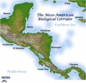 In the 1990s, the eight governments of the region (Panama, Costa Rica, Nicaragua, Salvador, Guatemala, Belize, Honduras and Mexico) agreed to coordinate their efforts to prevent biodiversity loss and create a huge system of interconnected parks, reserves and wildlife corridors that seamlessly link North America to South America. The vision is for an immense biological corridor connecting the forests of southern Mexico to those in the rest of Central America, all the way down to the Panama Canal.
Originally called the "Path of the Panther" and promoted by the Wildlife Conservation Society and by Dr. Archie Carr, founder of the Caribbean Conservation Corporation (now called the Sea Turtle Conservancy) that protects sea turtles on Costa Rica's Caribbean Coast, the project was adopted in 1997 by Central America's governments and changed its name to the Mesoamerican Biological Corridor (MBC).
The scale of the undertaking is massive. So far, Costa Rica is the only country that has elected a strategy of working with community and environmental organizations to create a chain of local biological corridors, using tax incentives, preservation easements, education, decentralized administration, partnerships with international organizations, and outright land purchases. As a result, Costa Rica has experienced a higher level of success in establishing the MBC than other countries in Central America.
Nevertheless, environmental destruction by real estate developers presents a serious threat to the environment. Additionally, if overall funding from international agencies is diminished or discontinued in the near future, it could mean the death of the entire Central American biological corridor project.
Costa Rica Central-Southern Pacific biological corridor
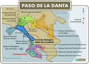 A long chain of coastal mountains extends down Costa Rica's Central Pacific Coast to the Southern Pacific and the Osa Peninsula. These mountains also stretch inland up to the Cordillera Central (Continental Divide) that runs like a long spine from north to south down Costa Rica into Panama.
Here is one of Costa Rica's largest biological corridor projects. Private conservation organizations are working to link the Osa Peninsula Biological Corridor in the south with the Inter-oceanic Biological Corridor, which spreads from the Savegre River Valley in the Central Pacific to the central mountain range and La Amistad International Park into Panama. Included in this area are the Tapir's Path Biological Corridor near Dominical, the Rio Naranjo Biological Corridor and Portasol Biological Reserve, occupying the space between three of Costa Rica's most well-known national parks – Corcovado, Manuel Antonio, and Los Quetzales.
Portasol
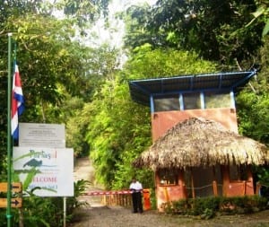 The Portasol Biological Reserve is unique because it is part of the Portasol Rainforest & Ocean View Community land development. Real estate development and conservation of biological corridors might seemingly be juxtaposed, but in Portasol's case, they work in harmony.
"It is a radically different concept of real estate; very different from other private reserves in Costa Rica," remarks Olivier Chassot, Ph.D., land owner at Portasol and Executive Director of the Tropical Science Center in Costa Rica. "Portasol is a good example of what a green economy is. The value of Portasol is in the trees and rivers and animals, and not its houses or hectares."
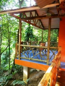 Portasol is located in the coastal mountains half-way between Manuel Antonio and Dominical, right near Playa Matapalo and the Savegre River. Set on 1,300 acres of pure rainforest along the Portalón River Valley, the sustainable residential community has building lots for sale and also offers tourism hospitality with unique vacation rentals. Two hundred acres of virgin forest near the top of the mountain has been set aside as a private nature reserve. The development is part of the Inter-oceanic Biological Corridor.
"Portasol is important because it is perpendicular to the mountain range and the sea, in its widest part," explains Chassot. "Birds, insects, animals and trees can move in the corridor and adapt to climate change by moving up with the warming trend."
Chassot noted that Portasol has a good elevation gradient with many different ecosystems. "Portasol has a great potential for biodiversity because of its widely varied environment from flat land to high mountains, valleys, rivers, creeks and forest," he said.
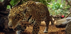 Chassot and his wife, Guisselle Monge Arias, Ph.D., both work with numerous conservation organizations in Costa Rica and Central America – the Tropical Science Center (one of the most influential institutions in Latin America in science and conservation), the Great Green Macaw Research and Conservation Project in Sarapiqui, the San Juan-La Selva Biological Corridor near Sarapiqui, and the Mesoamerican Society for Conservation Biology. They purchased a 1-hectare lot at Portasol in January 2013.
"We were really delighted by the forest environment," said Chassot. "We fell in love with the place. The sheer beauty is amazing … water everywhere, the trees. It's a real holistic development."
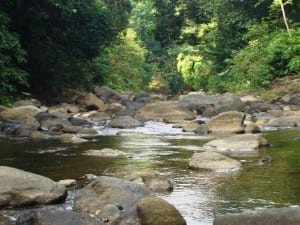 Chassot and Monge agree that Portasol is a model project on land use, offering large properties and a nationally registered ecological easement. The development has a rule that owners may only build on 15% of their land and must preserve the rest in green space. A conservation easement binds heirs and future landowners to comply with the easement's terms, ensuring that conservation purposes are met forever. Conservation easements were pioneered in the United States. Costa Rica, advised by The Nature Conservancy in the early 1990s, was the first country in Latin America to develop conservation easements and land trusts.
"We have been promoting ecological easements in our work," noted Chassot. "It is great that our neighbors will have to respect the terms of the easement and the land will be protected for our kids and grandkids, etc."
Added Monge: "There is much more awareness in Costa Rica today toward nature. People are thinking about preserving the natural resources of the country. Costa Rica is the most advanced nation in Central America in preserving its biological corridors."
By Shannon Farley
Etiquetas:
coastal properties costa rica,
costa rica biodiversity,
costa rica rainforest lodging land,
ecotourism costa rica,
real estate costa rica,
vacation rentals costa rica
Ubicación:
Portalón, Costa Rica
Reflexología, un enfoque holístico para sus malestares
 Reflexología se refiere al masaje en los pies para diagnosticar y curar enfermedades. Sus orígenes modernos se remontan a la década de 1930. En aquel tiempo, Eunice Ingham (1889-1974) mezcló los principios de la navaja de Ockham con las enseñanzas del Dr. William Fitzgerald. Estas últimas fueron publicadas en la obra Zone Therapy (1917), que dieron como resultado la disciplina actual. A diferencia de Fitzgerald, Ingham eliminó todas las 10 zonas de energía excepto la correspondiente a los pies.
Esta técnica se basa en la creencia de que cada parte del pie es un reflejo de una zona del cuerpo. Por ejemplo, el dedo gordo del pie funciona a modo de espejo en la cabeza. Así como los mapas de la iridología, el pie derecho corresponde a la parte derecha del cuerpo y el izquierdo al otro lado. Por este motivo, los practicantes de la rama se consideran profesionales de la salud holística y no podólogos.
En esta línea, el tratamiento también se utiliza como terapia complementaria junto a otros procedimientos médicos. La reflexología funciona, sin lugar a dudas, como añadidura a la atención estándar de los doctores de cabecera o especialistas. Por ende, la terapia reflexológica no debe considerarse como remplazo para la atención con un experto en salud.
 Sus beneficios y ventajas son muchos. El principal es la disminución del estrés. Esto se debe a que las manos y los pies son instrumentales en el establecimiento de los niveles de tensión de todo el cuerpo. De tal forma, pueden interrumpir las señales de las preocupaciones, además de restaurar el equilibrio y la homeostasis en el cuerpo.
Para los reflexólogos, con la estimulación de ciertos puntos se puede curar una variedad de males y dolores. Argumentan que calman migrañas y alivian la sinusitis. Restablece la armonía tras desequilibrios hormonales, resuelve los trastornos digestivos y los problemas respiratorios. Si usted tiene alguna molestia en la espalda y le aplican un masaje en el sitio correcto, puede apaciguar la dolencia. Asimismo, puede ayudarle en algunas otras circunstancias:
- Dificultades para relajarse.
- Problemas el flujo sanguíneo.
- Inconvenientes con el colesterol, la presión arterial y las lecturas de electroencefalogramas o electrocardiogramas.
- Recuperaciones postoperatorias.
- Tratamientos de cáncer, hemodiálisis y síndrome del miembro fantasma.
- Ansiedad, estrés postraumático y depresión.
- Facilitación del parto y su recuperación posterior.
Existen muchas variedades distintas: zone therapy, vacuflex y vita flex. Una importante de destacar es la terapia de polaridad, una variante de la reflexología que remplaza la oposición yin y yang con las cargas de energía positiva o negativa de los lados del cuerpo.
De igual manera, algunos podólogos también son reflexólogos, pese a que no existe una relación directa entre ambas disciplinas. Asimismo, suele combinársela con otras terapias como la acupresión, shiatsu, yoga y taichí.
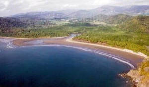 Las sesiones de reflexología suelen durar entre 30 minutos y una hora. El reflexólogo utilizará las técnicas de estiramiento, presión y movimiento para trabajar metódicamente en todo el pie. Solo debe visitar personal capacitado y con experiencia ya que la presión excesiva puede ser perjudicial e incluso provocar lesiones. Por ende, comuníquese con su reflexólogo e indíquele si sufre de dolor durante el procedimiento.
Si desea experimentar en primera persona los beneficios de esta técnica, el hotel Vista Las Islas se la ofrece de modo complementario. Este alojamiento tiene una clasificación de cuatro estrellas, con vista al bar y una amplia gama de comodidades. Debido a su localización en las costas del sur de la península de Nicoya, goza de vistas panorámicas inigualables, acceso a la playa y actividades varias.
Por: Andrés Figueroa Vásquez.
Costa Rica's Carara National Park is tops with nature lovers
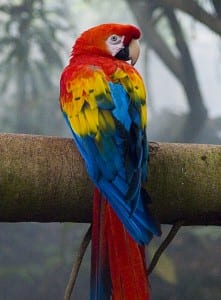 One of the most brilliantly beautiful tropical birds is definitely the Scarlet Macaw (Ara macao). Its loud, raucous squawks carry for miles, so usually you hear them before you see them. When you do sight a Scarlet Macaw in the wild, they are breathtaking – fire engine red bodies with sunshine yellow and royal blue wing feathers tinged with a bit of green, and a distinct stark white patch around both eyes.
An endangered species, Scarlet Macaws live in tropical forests from Mexico to South America. In Costa Rica, they live in dry, moist, and wet tropical lowland forests along the Pacific Coast where large mature trees provide nesting and food of nuts, fruits and flowers.
One of the best places to see wild Scarlet Macaws is at Carara National Park. You can also see them along the Central Pacific Coast from Herradura to Manuel Antonio, and in the Corcovado National Park on the Osa Peninsula.
Carara National Park is located in a transition zone between tropical dry forest of Costa Rica's Northern Pacific and tropical rainforest of the Southern Pacific. This makes the Park home to a vast variety of wildlife and plants. Carara is one of 28 national parks in Costa Rica. Spannng 12,950 acres, it was created in 1978 first as a biological reserve and then made a national park in 1998.
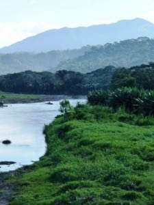 Carara is exceedingly popular due to its easy accessibility and proximity to the capital city and the highly-trafficked beach town of Jaco, the Los Sueños Resort at Herradura Bay, and the Pacific cruise ship port of Caldera. But if you get there early, right when the park opens, or go late in the day near closing time, you can beat the crowds and have the nature and wildlife to yourself. Early morning, or around sunset is often the best time to see animals living in the park, especially Scarlet Macaws.
The Carara National Park protects the Tarcoles River valley on the Pacific Coast. Its forests are dense and high, and the park has a mixture of primary and secondary forests, lagoons, rivers and waterfalls. The huge trees here are often covered with vines and epiphytes. Pre-Columbian archaeological sites are scattered throughout the area.
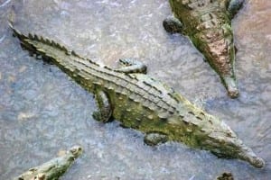 The park's name is the native Huetar word for crocodile. Visit the park and you'll understand why since the Tarcoles River, which forms the park's northern boundary, is famous around the world for its giant and plentiful crocodiles. The Tarcoles River Bridge on the Coastal Highway is a favorite place for tourists to stop and view the monster-sized crocodiles below. Boat tours on the river also are very popular.
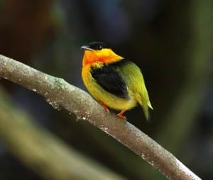
More than anything, though, Carara National Park is known for being a bird watching paradise. About 48% of Costa Rica's avian species, including one of the country's largest remaining wild populations of Scarlet Macaws, live in the park. More than 360 species of birds have been recorded in Carara, including toucans, parrots, aracaris, trogons, kingfishers and herons.
Other wildlife you are likely to see include white-faced Capuchin monkeys, agoutis, coatis, sloths, peccaries, anteaters, armadillos, boa constrictors and poison-arrow frogs.
 The park has two trails to explore, each of which is approximately 2 miles (3 km) in length. There is a new shorter wheelchair accessible trail as well. It is best to go with a naturalist guide who will point out plant and animal species and explain the park's ecology.
Carara National Park is located 9.3 miles (15 km) north of Jacó and about an hour from San Jose. The Quebrada Bonita Ranger Station sits along Hwy 34 just minutes south of the Tarcoles River. The rangers will be happy to give advice and current information on wildlife. The park opens at 7 a.m. and closes at 4 p.m. The entrance fee is $10. Don't forget to bring insect repellent.
You can visit Carara National Park with Costa Rica travel agency Team CRT on their 7-day/6-night Costa Rica National Parks vacation package. The agency knows the best of the country, what to do and see, and they personalize it for you, designing your Costa Rica vacation to fit exactly what you want. From nature tours to beach destinations, adventure tours, family vacations, relaxation vacations, honeymoons and golf vacations, Team CRT delivers you unforgettable Costa Rica vacation packages. They also offer vacation packages to neighboring Panama and Nicaragua.
Team CRT is committed to sustainable tourism vacations that actively involve the local community in Costa Rica.
By Shannon Farley
Etiquetas:
about costa rica,
costa rica national parks,
costa rica nature tours,
costa rica vacation packages,
costa rica wildlife,
scarlet macaws
Ubicación:
Carara National Park, 34, Costa Rica
El Parque Nacional Piedras Blancas
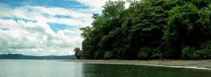 El Parque Nacional Piedras Blancas (PNPB) fue creado por el decreto ejecutivo #20.522 del MIRENEM el 17 de setiembre de 1991. Se encuentra en la costa sur del Pacífico de Costa Rica, específicamente en el golfo Dulce (Puntarenas). Está al oeste de la ciudad de Golfito, al noroeste de la autopista Interamericana. Colinda al este con el Refugio Nacional de Vida Silvestre Golfito y al oeste con la Reserva Forestal Golfo Dulce y el Humedal Térraba-Sierpe.
Tiene un clima tropical muy húmedo, con una estación lluviosa que se alarga de mayo a febrero. Por ende, solo existe un brevísimo período seco entre marzo y abril. Las precipitaciones anuales oscilan entre los 4.000 y 6.000 mm. La temperatura es cálida, con un promedio de 28 grados centígrados.
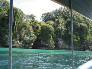 Su superficie está conformada por 1.200 hectáreas marinas y por 14.025 hectáreas terrestres. De estas, 1.895 se encuentran alteradas por diversos motivos: aprovechamiento forestal, actividades agrícolas, ganadería o cubiertas por matorrales.
Posee mucha agua superficial y los ríos arrastran arenas auríferas de poca riqueza.
La vegetación es característica del bosque tropical húmedo lluvioso de la vertiente pacífica centroamericana. El terreno tiene una acidez relativamente alta y la flora se compone de árboles de hasta 50 metros de altitud. Entre ellos destacan el ceiba, nazareno y pilón, muchos de los cuales sirven de base para el surgimiento de musgos, plantas epífitas y helechos.
La fauna es muy diversa con especies como jaguares, saínos, tepezcuinltes y tigrillos caucel. Cabe mencionar la gran variedad de especies aviarias que habitan tanto en la región boscosa como a las orillas del mar.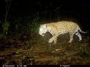 Es preciso resaltar las lapas rojas (que son las más grandes del planeta) y los quetzales (los cuales descuellan por su gran belleza). También es posible hallar yigüirros, pavas negras, gavilanes cangrejos, tucanes y pelícanos buchones. La presencia de anfibios es extraordinaria, donde sobresalen las ranas rojas venenosas.
 Es preciso resaltar las lapas rojas (que son las más grandes del planeta) y los quetzales (los cuales descuellan por su gran belleza). También es posible hallar yigüirros, pavas negras, gavilanes cangrejos, tucanes y pelícanos buchones. La presencia de anfibios es extraordinaria, donde sobresalen las ranas rojas venenosas.
El PNPB fue creado con la intención de asegurar el resguardo del último bosque tropical lluvioso de la zona de Golfito y la cuenca del río Esquinas. En tiempos pasados, este territorio era componente del Parque Nacional Corcovado. Sin embargo, debido a su tamaño y a su situación geográfica, se decidió separarlo para que tuviera una mejor tutela por parte del Sistema Nacional de Áreas de Conservación (SINAC).
Un rasgo particular de esta área es que en ella están permitidas las concesiones. Además, están habilitadas la investigación y la construcción de infraestructura para diversas actividades científicas, recreativas y de educación medioambiental. Pese a ser una zona protegida, aún hoy en día existe población humana dentro de sus confines.
La mayoría de sus habitantes llegaron al parque en las décadas de 1960 y 1970. En aquel entonces se deforestó un 9% de la superficie para dedicarla a la agricultura de subsistencia –sobre todo arroz y frijoles– y ganadería.
Para 1999 había aproximadamente 115 familias, con un promedio de 5 personas por prole (para un total de 565 individuos). Este conjunto de personas se reparten en dos comunidades: Riyito y La Playa. Un aspecto a destacar es que para el momento de la creación del área protegida no se informó a los residentes al respecto. Lo anterior, además de las deudas del Estado con los propietarios originales, permitió que continuara el desarrollo de actividades extractivas propias de la región.
Por otro lado, las rutas para acceder a este lugar siguen el trayecto de los autobuses de San José a Golfito. Posteriormente, si no se va en vehículo propio, se debe tomar un taxi para alcanzar La Gamba (Villa Briceño). Luego se debe caminar a través de bosques y afluentes hasta el centro operativo El Bonito, ya dentro de la zona de protección natural. Construcciones y servicios. Existen tres zonas para practicar el senderismo. Todas ellas se ubican a poca distancia del centro operativo. Además, es posible observar muestras de la biodiversidad majestuosa y la riqueza fluvial propias del bosque tropical lluvioso.
Otra opción de gran relevancia es el recorrido por el río Esquinas, que parte del muelle de Golfito. Este posee un tramo navegable de aproximadamente 5 kilómetros. Asimismo, en las cercanías del parque nacional está el depósito libre de Golfito que le brinda opciones de compra o servicios varios para su comodidad.
Además, dentro del PNPB hay opciones de alojamiento de alto estándar. Por ejemplo, el hotel Playa Nicuesa le ofrece una mezcla perfecta de comodidad y armonía con la naturaleza. Este sitio exclusivo con sensibilidad hacia el medio ambiente. Fue construido por árboles caídos naturalmente, materiales reciclados y aprovecha la energía natural del sol para producir electricidad.
jueves, 20 de junio de 2013
Extraordinary wildlife abounds at Veragua Rainforest
What if I told you there was an animal without lungs that lives on land and can grow back any limb of its body?
Crazy, you say? Well, in the Costa Rican Caribbean rainforest, there is a species of salamander that can.
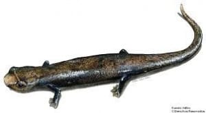 Salamanders are amphibians that are typically characterized by a lizard-like appearance, with slender bodies, short noses, and long tails, according to Wikipedia. There are approximately 550 species of salamanders that live in Temperate and Neotropical zones around the world.
Unique among vertebrates, salamanders are capable of regenerating lost limbs. For instance, they often lose their tail when attacked in order to escape quickly and distract their predator. Within only a few weeks of losing a piece of limb, a salamander perfectly reforms the missing segment, notes Wikipedia.
Salamanders' limb regeneration has been the focus of significant interest among scientists, because they are considered the epitome of perfect regeneration. Researchers have been trying to find out the conditions required for regeneration to be able to duplicate the process with humans.
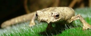 The salamanders that inhabit Costa Rica also have no lungs, so their respiration occurs through their delicate skin and the tissues lining their mouths. Their moist skin usually makes salamanders reliant on habitats in or near water, or in moist ground such as in the rainforest.
At Veragua Rainforest in Costa Rica's Caribbean area, there is an abundance of salamanders. The diversity of amphibians and reptiles of Costa Rica's Central Caribbean had been little studied until the University of Costa Rica and Veragua Rainforest's biologists began investigating the region.
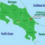
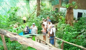 Veragua Rainforest is a 1,300 hectare (3,212 acre) biology research site and adventure center, located about an hour inland from the Caribbean Coast and the port town of Limón. It is an area of dense tropical rainforest in the foothills of the Talamanca Mountains bordering the La Amistad ("Friendship") International Park, the country's largest and most remote national park that is shared by Costa Rica and Panama. Veragua's biologists partner with the University of Costa Rica (UCR), the National Institute of Biodiversity (INBio), and the National Museum of Natural History to preserve the area's population of frogs, snakes, lizards, iguanas, insects, butterflies and birds.
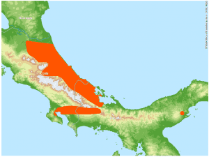 The most popular salamander at Veragua Rainforest is the La Loma Salamander, or Tropical Climbing Salamander (Bolitoglossa colonnea), a species of lungless salamander found in Costa Rica and Panama, reports resident biologist Wagner Chaves. The La Loma Salamanders are native to the Western Hemisphere, from British Columbia to Brazil. The species is threatened by habitat loss – tropical moist lowland and tropical montane forests.
 Veragua Rainforest offers an excellent educational opportunity for students and educators with hands-on research of rainforest life. The park is not-to-be-missed when visiting Costa Rica's Caribbean area. The property contains a biology research station, wildlife habitats, rainforest walking trails, a river and waterfall, an aerial tramway, a canopy zip line tour, student group accommodations, and a restaurant, café and souvenir shop. The Park is open to day visitors Tuesday to Sunday, from 8:00 am to 3:00 pm.
By Shannon Farley
Etiquetas:
activities costa rica caribbean,
costa rica animals,
costa rica facts,
costa rica nature,
costa rica wildlife,
rainforest adventure tours costa rica
Ubicación:
Limon, Costa Rica
53 Costa Rica tourism businesses signed the Ethics Code.
Fifty-three tourism companies in Costa Rica have agreed to uphold the Global Code of Ethics for Tourism of the United Nations World Tourism Organization (UNWTO).
At the 55th meeting of the Commission of the World Tourism Organization (UNWTO) for the Americas, held for the first time in Costa Rica from May 13-15, 2013, the national tourism companies signed the Global Code of Ethics for Tourism (GCET), committing to the development of responsible and sustainable tourism. The GCET is composed of 10 principles that guide governments, the travel industry, communities and tourists in economic, social, cultural and environmental components of tourism.
Adopted in 1999 by the General Assembly of the World Tourism Organization, the GCET is not legally binding. The Code is voluntary and is governed by the World Committee on Tourism Ethics (WCTE), to which stakeholders may refer matters concerning the application and interpretation of the document.
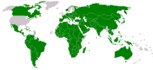 Members of the World Committee for 2012-2013 were elected by the UNWTO Regional Commissions and the UNWTO Affiliate Members, and endorsed by the UNWTO General Assembly at its 19th session in October 2011. Members represent UNWTO's six Regional Commissions – Africa, Americas, East Asia & Pacific, Europe, Middle East, and South Asia. For the Americas, the Committee Member is Mr. Hermes Navarro del Valle of Costa Rica.
"UNWTO is guided by the belief that tourism can make a meaningful contribution to people's lives and our planet. This conviction is at the very heart of the Global Code of Ethics for Tourism, a roadmap for tourism development," states UNWTO Secretary-General Taleb Rifai (2010-present) on UNWTO's website.
On the UNWTO website there is an excellent brochure called "Practical Tips for the Global Traveler" that highlights the principles of the GCET directly related to tourists, in order to help guide travelers in making their behavior more responsible. The brochure is downloadable in PDF format and is available in 5 languages.
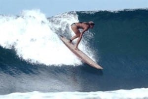 Tour operators, hotels, travel agencies and rent-a-car companies were some of the Costa Rican tourism businesses who agreed on a voluntary basis to the guidelines. Top Costa Rica surf school, Del Mar Surf Camp, was one of those that signed the Global Code of Ethics for Tourism. Del Mar is affiliated with Costa Rica's National Tourism Chamber, the Costa Rican Tourism Board, the International Surfing Association, and the Central Pacific Chamber of Commerce.
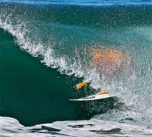 Del Mar Surf Camp specializes in Costa Rica surf vacations for beginners and advanced surfers, family and group vacations, women-only trips, yoga-surf retreats, stand-up paddle programs, and day surf lessons. They operate in three locations in Costa Rica: Hermosa Beach on the Central Pacific Coast, Santa Teresa Beach on the Pacific's Nicoya Peninsula, and Nosara Beach on the Guanacaste Pacific Coast.
Get away from your daily routine of life, have fun on an adventure, experience new places, make new friends, and create memories that will last a lifetime on a Costa Rica surf vacation.
The GCET's 10 principles are:
- Article 1: Tourism's contribution to mutual understanding and respect between peoples and societies: It promotes responsible tourism that adheres to ethical values common to humanity, and tolerance and respect for diversity. It also states that it is the task of public authorities to protect tourists and visitors and their belongings. Tourists and visitors have the responsibility to acquaint themselves, even before their departure, with the characteristics of the countries they are preparing to visit, and host communities must respect the tourists who visit them.
- Article 2: Tourism as a vehicle for individual and collective fulfillment: It states that travel is an irreplaceable factor of self-education, mutual tolerance and for learning about the legitimate differences between peoples and cultures and their diversity; it advocates respect for equality and human rights.
- Article 3: Tourism, a factor of sustainable development: It mandates safeguarding the natural environment.
- Article 4: Tourism, a user of the cultural heritage of mankind and contributor to its enhancement: Tourism policies and activities should be conducted with respect for the artistic, archaeological and cultural heritage, which they should protect and pass on to future generations.
- Article 5: Tourism, a beneficial activity for host countries and communities: Tourism policies should be applied in such a way as to help to raise the standard of living of the populations of the regions visited and meet their needs.
- Article 6: Obligations of stakeholders in tourism development: Tourism professionals have an obligation to provide tourists with objective and honest information on their places of destination and on the conditions of travel, hospitality and stays.
- Article 7: Right to tourism: The discovery and enjoyment of the planet's resources constitutes a right equally open to all of the world's inhabitants.
- Article 8: Liberty of tourist movements: Tourists and visitors should have the liberty to move within their countries and from one State to another, in accordance with Article 13 of the Universal Declaration of Human Rights, and without being subject to excessive formalities or discrimination.
- Article 9: Rights of the workers and entrepreneurs in the tourism industry: The fundamental rights of salaried and self-employed workers in the tourism industry and related activities should be guaranteed under the supervision of the national and local administrations.
- Article 10: Implementation of the principles of the Global Code of Ethics for Tourism: The public and private stakeholders in tourism development should cooperate in the implementation of these principles and monitor their effective application.
By Shannon Farley
Etiquetas:
active vacations,
adventure vacations costa rica,
Costa Rica surf schools,
Costa Rica surf vacations,
surf costa rica,
UNWTO global code ethics tourism
Ubicación:
Costa Rica
Sámara ha sido sede de varios eventos de atletismo en los últimos meses.
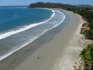 El pueblo costero de Sámara, en la provincia de Guanacaste, ha creado una marca como destino deportivo. Por ello, ha sido sede de varios eventos de atletismo en los últimos meses. Así, los pasados 18 de mayo; 1 y 2 de junio se desarrolló la segunda edición del Festival Deportivo Sámara 2013, donde se incluyó un triatlón extremo con ciclismo y carreras de montaña, además de natación en aguas abiertas. Los organizadores del Multirreto Aventura procuraron que el programa estuviera dividido en dos fines de semana distintos. Su objetivo fue que los hoteles de la zona pudieran recibir adecuadamente la gran afluencia de visitantes.
Las justas deportivas fueron planeadas en conjunto con la Cámara de Turismo (CASATUR). Se buscaba que el flujo de turistas a la zona sirviera para el beneficio de los grupos organizados locales. Playa Sámara posee un potencial enorme para las actividades de ecoturismo. Dicho aspecto que cobra vital importancia en Guanacaste, que ha sido sobreexplotado con un modelo turístico mal planeado.
 Para la parte de natación del triatlón XTRI, los atletas fueron transportados a la isla de Chora y para luego volver a la orilla. La ruta de la carrera de montaña fue de 8,1 kilómetros a lo largo de playa Cangrejal. Por su parte, el ciclismo de montaña fue a través de la zona de Santo Domingo, dando la vuelta por Buena Vista hasta cruzar el río, pasar por Cantarana y playa Cangrejal hasta Villas Playas Sámara. Había opción de competir en todos los eventos o elegir varios.
Por su parte, el pasado 1 de junio se realizó la segunda edición de CREAR Combate. Parte de los desafíos que enfrentaron los concurrentes fueron: surf a ciegas, burro y carretillo.
Al igual que el año anterior, los grupos concurrentes de cuatro personas se dedicaron a hacer ciclismo, correr, nadar y practicar surf. Ahora, no obstante, luego de montar las olas, los equipos debieron dirigirse a un surfista con los ojos vendados hasta un punto de control. A partir de ahí, cada conjunto se enrumbó hacia la meta siguiente jugando burro. Posteriormente, hicieron carretillo y acabaron con una última tarea: hacer una figura de sirena en la costa.
 Si bien era un encuentro deportivo, también hubo gran espacio para la diversión y el trabajo en equipo. Incluso se desarrolló un ambiente apto para los más chicos. Se dispuso de una zona infantil con juegos y otras actividades como fabricación de pulseras y pinta caritas. Asimismo, contaron con un «minicombate» que consistió en saltar en medio de aros, correr con un huevo, jugar carretillo y otros entretenimientos divertidos. Los servicios no tenían costo y al final hubo premios para los niños ganadores.
Según Johannah Waite, directora de desarrollo de CREAR, «el evento fue todo un éxito, pues se contó con varios equipos y con muchos niños participantes. Mucha gente nos comentó que estaban encantados con la actividad porque era aptar para las familias». Para ella, esto fue un aliciente para contar con una concurrencia mayor en ediciones posteriores.
Con el dinero recaudado se financiarán otras acciones de la organización, entre los que se encuentran la compra de suministros y el transporte para un campamento de verano. Este se hará en julio por la zona de El Torito y en él participarán las escuelas de Sámara. Adicionalmente, los recursos se destinarán a otros programas educativos.
Queda patente cómo el sector turístico de la región se traduce en beneficios para la comunidad que le sirve de sede. Por ello es tan importante apoyar las iniciativas locales. Un ejemplo de esto es Monkey Tours, una empresa dedica da a excursiones cortas de dosel, cabalgatas, puentes colgantes y avistamiento de aves. Además, le facilitan la posibilidad de vivir en primera persona la creación típica de cerámica y las maravillas de la playa y el bosque nuboso.
Por: Andrés Figueroa Vásquez.
Scientists challenge world leaders to reduce CO2 levels
Leading climatologists are calling on world leaders to take better action to control climate change after carbon dioxide levels in the atmosphere were measured at a disturbingly record-breaking high last month.
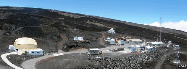
The Earth System Research Laboratory, belonging to the U.S. National Oceanic and Atmospheric Administration (NOAA) on Mauna Loa Volcano in Hawaii, measured its daily average CO2 reading at more than 400 parts per million for the first time (that is 400 molecules of CO2 for every 1 million molecules in the air). The daily average CO2 figure on May 9 was 400.03, reported Dr. James Butler who is in charge of the Earth System Research Laboratory.
The last time CO2 regularly reached this level, scientists say, was 3 to 5 million years ago, before modern day humans existed, according to BBC News reports. Scientists say the climate back then was also considerably warmer than it is today.
"Mauna Loa and the South Pole observatory are iconic sites as they have been taking CO2 measurements in real time since 1958. Last year, for the first time, all Arctic sites reached 400ppm (parts per million). This is the first time the daily average has passed 400ppm at Mauna Loa," explained Dr. Butler in news reports.
The long-term measurements at Mauna Loa were started by Scripps Institution of Oceanography scientist Charles Keeling. In 1958, he found the concentration at the top of the volcano to be around 315ppm.
Every year since then, the "Keeling Curve", as it has become known, has been inching higher, news reports stated.
Every year since then, the "Keeling Curve", as it has become known, has been inching higher, news reports stated.
 Carbon dioxide is regarded as the most important of the man-made greenhouse gases, coming principally from the burning of fossil fuels such as coal, oil and gas, and is blamed for raising the temperature on the planet over recent decades. The usual trend seen at Mauna Loa is for the CO2 concentration to rise in winter months and then to fall back as the northern hemisphere growing season kicks in, notes BBC news reports. Forests and other vegetation pull some of the gas out of the atmosphere. This means the number can be expected hopefully to decline below 400 in the coming weeks, but the long-term trend is moving upwards.
Professor Sir Brian Hoskins, head of climate change at the UK-based Royal Society and director of the Grantham Institute for Climate Change at Imperial College London, told the BBC that the new record-breaking figure should "jolt governments into action." Professor Hoskins said a greater sense of urgency was needed to control climate change.
"Before we started influencing the amount of carbon dioxide in the atmosphere, over the last million years it went between about 180 and 280 parts per million," reported Professor Hoskins. "Now, since the Industrial Revolution, and more in the last 50 years, we've taken that level up by more than 40% to a level of 400, and that hasn't been seen on this planet for probably 4 million years."
 Professor Hoskins did say that the forecast is not all doom and gloom. He noted that changes are happening around the world. For instance, in the United States, a switch from coal to gas in power generation helped reduce carbon dioxide emissions by 200 million tons, bringing them back to the level of the mid-1990s, according to the International Energy Agency. Even though the use of coal increased in some European countries last year due to low prices, emissions in Europe declined by 50 million tons because of the economic slowdown, among other reasons, reported the Paris-based IEA.
The International Energy Agency urged governments to quickly adopt four policies that would ensure climate goals could be reached without harming economic growth. They are: improving energy efficiency in buildings, industry and transport; limiting the construction and use of inefficient power plants; halving methane emissions; and partially phasing out fossil fuel subsidies. These would reduce global energy-related emissions by 8 percent or 3.1 billion tons of CO2 equivalents in 2020, the IEA stated.
Costa Rica has committed to be the first carbon-neutral country by 2021. Costa Rica has been touted in recent months as a world environmental leader for its conservation policies.
The Central American country has become an international ecotourism destination in the past decade.
The Central American country has become an international ecotourism destination in the past decade.
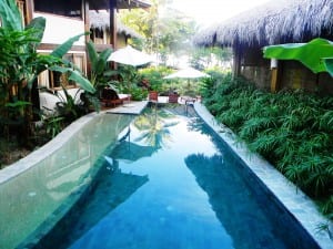 On environmental award-winning beach Santa Teresa, Costa Rica, the boutique hotel Pranamar Oceanfront Villas & Yoga Retreat is a prominent planet-conscious place to stay. The yoga-surf hotel in this southern Nicoya Peninsula paradise takes its commitment to the environment seriously.
The luxury hotel reclaims and cleans its water used at the property to irrigate their organic gardens. They use no herbicides or pesticides on the property. Much of the vegetation is "edible" – fruits, vegetables and herbs supply Pranamar's open-air restaurant with fresh, healthy cuisine. The hotel's composting system completes the food cycle by turning the restaurant's organic waste into natural fertilizer.
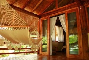 Sustainably farmed and recycled woods were used to construct Balinese-style bungalows and villas. All soaps, laundry detergent, cleaning supplies, and guests' bath amenities are biodegradable. Energy-saving light bulbs and appliances reduce electricity usage. Even the free-form swimming pool is eco-friendly; it's filled with salt-water, meaning less chlorine and other chemicals.
By Shannon Farley
Etiquetas:
costa rica carbon neutral policy,
eco-friendly hotels,
ecotourism destinations costa rica,
playa santa teresa costa rica,
sustainable hotels costa rica
Ubicación:
Costa Rica
lunes, 17 de junio de 2013
Best Hanging Bridges Tours in Costa Rica
Little was known about life up in the canopy of tropical forests until biologists started using ropes and pulleys to climb their way up. Treetops in the tropics reach so high that it was nearly impossible to explore.
 Scientists now know that about 90% of all of the organisms in a rainforest are found in the tree canopy. In the tropics, trees and plants stretch upwards as high as they can to get some sun, which barely reaches the forest floor. At the top, the brilliant sunlight hits everything, resulting in the plentiful growth of leaves, fruits and seeds. It only follows that if there is good food at the top, so too will there be an abundance of animals.
Nowadays, biologists study the tropical forest canopy using towers, suspension (hanging) bridges, and construction cranes. In Costa Rica, you can easily explore the rainforest and cloud forest from this elevated perspective to see interesting plants and wildlife thanks to aerial walking trails on hanging bridges tours. Though the name "hanging" implies something that might swing through space, Costa Rica's hanging bridges tours use safe metal structures.
Costa Rica offers many hanging bridges tours, mostly around Arenal Volcano and in the Monteverde cloud forest. Valle Dorado Tours offers you many options for hanging bridges tours. Here is a guide to the best Costa Rica hanging bridges tours.
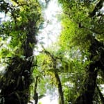 Located in Costa Rica's Central Highlands, the misty mountaintop of Monteverde is a prime tourism destination. Monteverde's rare ecosystem is internationally famous as one of the most extensive cloud forests in Central America. At 1,800 m (5,900 ft.) elevation, this natural sanctuary is like a lofty green cathedral – towering trees drip with dew-soaked hanging moss and vines, splashed with colorful delicate orchids, bromeliads and ferns in all shapes and sizes. More than 2,500 different types of plants and animals, including 400 species of birds, call Monteverde's cloud forest home.
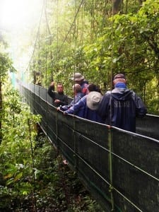 Sky Walk is Costa Rica's first hanging bridges tour. Since 1997, Sky Walk has led tourists on walking trails and suspension bridges through the Monteverde cloud forest near the Santa Elena Reserve. There are six bridges in total, the longest of which spans 984 feet, and some reach soaring heights above canyons. Trails cover slightly over 1.5 miles (2.5 km), making this tour accessible for anyone in moderate shape. The trails are not strenuous or muddy, and are well-maintained and generally very flat. Local guides lead the tours and help visitors learn about native plant and animal species.
Sky Walk lasts about 2-3 hours. Tours depart at 7:30 a.m., 9:30 a.m., 11:30 a.m. and 1:30 p.m. Groups can be no larger than 10 persons because there is a 12-person maximum capacity per bridge. Reservations are recommended.
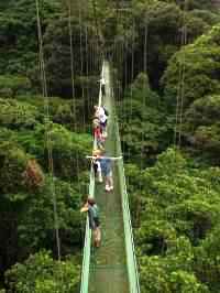 A little higher up the mountain than Sky Walk, closer to the Santa Elena Reserve in Monteverde, is Selvatura's Treetop Walkways. The nearly 2 mile (3 km) trail crosses through this high elevation cloud forest with eight bridges. Lengths range from 150 feet (50 m) to 510 feet (170 m) with heights between 36 feet (12 m) up to 180 feet (60 m). The metal bridges are quite wide at 5 feet and have a strength capacity of up to 80 persons per bridge. The treetop walkways are suitable for all ages and physical conditions. You may reserve guided or self-guided tours; the tour lasts usually about 2 hours.
ARENAL VOLCANO
Tall, impressive Arenal Volcano is one of the top places to visit in Costa Rica. Towering above the rainforest that surrounds its base and the beautiful Lake Arenal, the active volcano's perfectly symmetrical conical shape makes it a stunning sight.
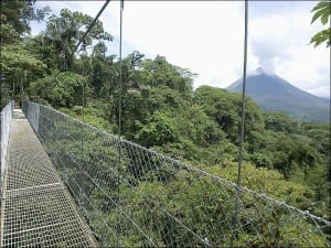 Located near Lake Arenal and Arenal Volcano, the Arenal Hanging Bridges tour is a fantastic rainforest experience. Trails built with paving blocks (to prevent slipping) ramble 2 miles (3 km) through dense rainforest around gigantic trees and then out across gorges and over treetops on suspension and fixed bridges. The tour consists of eight fixed bridges, 26-72 feet long (8-22 meters), and six hanging bridges between 157-321 feet long (48-98 meters). The spectacular views of Arenal Volcano from the hanging bridges are unforgettable. Tours may be guided by a naturalist or self-guided. Walk quietly and you will be able to see a wealth of wildlife, from tropical and migratory birds to monkeys and small mammals.
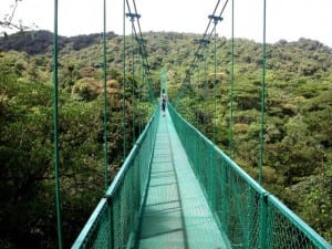 Similar to Sky Walk in Monteverde, the Sky Walk tour at Arenal Volcano offers you breathtaking views of the forest canopy up close, as well as the volcano and Lake Arenal. The fun half-day adventure takes you along trails, hanging bridges and viewing platforms; the tour is accessible to all ages and physical conditions. Naturalist guides will inform you about life in the area. The Sky Walk tour lasts about 2.5 hours. Tours depart at 7:00 a.m., 8:00 a.m., 9:00 a.m., 11:30 a.m., 12:30 p.m. and 2:00 p.m. Groups can be no larger than 10 persons because there is a 12-person maximum capacity per bridge. Reservations are recommended.
Valle Dorado Tours offers the best Costa Rica one-day tours and custom tour packages. More than 20 years of local experience in the Costa Rica travel business ensures that Valle Dorado Tours offers you the best in Costa Rica vacations. Check out their extensive menu of one-day tours, traditional destination tour packages, thematic tour packages and customized tour packages all over Costa Rica.
By Shannon Farley
Etiquetas:
adventure tours costa rica,
arenal tours activities,
costa rica hanging bridges tours,
monteverde tours activities,
vacation packages costa rica
Ubicación:
Limon, Costa Rica
Suscribirse a:
Entradas (Atom)
